

Hopp til hovedinnholdet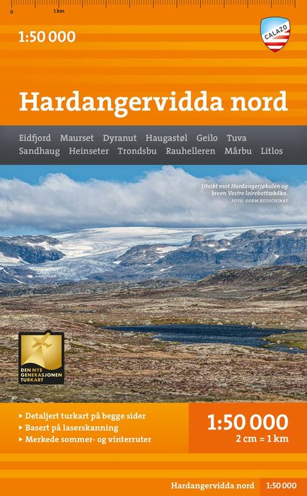
Hardangervidda nord
Utgitt 2022.Del av serien Den nye generasjonen turkart.
With map views on both the front and back, this map covers the northern part of Hardangervidda between the cabins Litlos and Mårbu in the south and national highway 7 in the north. Classic destinations here are, among other things, Rauhelleren, Sandhaug and easily accessible trips to Vøringsfossen and Halnekollen. This is part of the modern map series from Calazo with a unique richness of detail based on new data obtained from laser scanning by aircraft. The map covers all the most popular mountain areas, marked hiking routes in the area, DNT cabins and private accommodation cabins. It works just as well in winter with marked winter routes and groomed ski slopes.
Kart, falsetNorsk
239,-
Ved å fullføre kjøpet aksepterer jeg kjøpsvilkårene.
Tilgjengelig i 6 butikker
På nettlager. Sendes innen 1-2 virkedager.
Hardangervidda nord
Utgitt 2022.Del av serien Den nye generasjonen turkart.
With map views on both the front and back, this map covers the northern part of Hardangervidda between the cabins Litlos and Mårbu in the south and national highway 7 in the north. Classic destinations here are, among other things, Rauhelleren, Sandhaug and easily accessible trips to Vøringsfossen and Halnekollen. This is part of the modern map series from Calazo with a unique richness of detail based on new data obtained from laser scanning by aircraft. The map covers all the most popular mountain areas, marked hiking routes in the area, DNT cabins and private accommodation cabins. It works just as well in winter with marked winter routes and groomed ski slopes.
239,-
Kart, falsetNorsk
Ved å fullføre kjøpet aksepterer jeg kjøpsvilkårene.
Tilgjengelig i 6 butikker
På nettlager. Sendes innen 1-2 virkedager.
239,-
Ved å fullføre kjøpet aksepterer du kjøpsvilkårene.